By Rachel Hergett MSU NEWS SERVICE
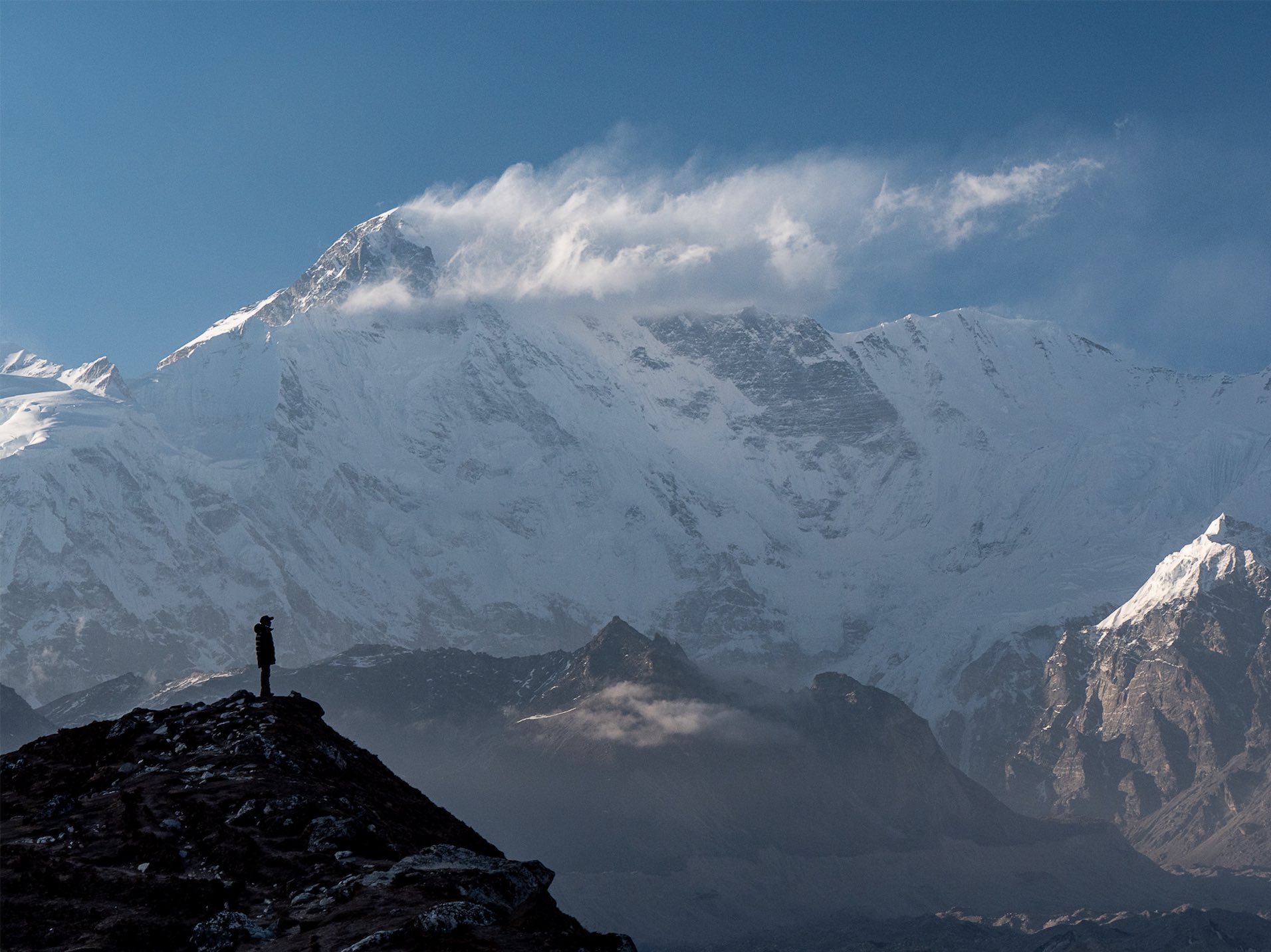
BOZEMAN – The Himalaya Mountains are an active site of continental collision, where the meeting of tectonic plates forces the Earth’s surface to great heights. At the same time, in the face of extreme conditions, the mountains are also rapidly eroding.
Mountain building is closely tied to climate, according to structural geologist Mary Hubbard, a professor in Montana State University’s Department of Earth Sciences in the College of Letters and Science. While forces under the surface of the Earth cause mountains to rise, climate trends, such as annual monsoons, fill the rivers and send landslides down the valley walls. But details of this process have not been studied extensively in remote areas like the high Himalaya. A Sanskrit word meaning “house of snow,” “Himalaya” is the preferred term used by locals and researchers to refer to the range of mountains and region they dominate.
This spring, Hubbard co-led one of two teams of geologists on an interdisciplinary expedition to Mount Everest led by National Geographic and Tribhuvan University that sought to fill the scientific void in the Himalaya. It was the first in a series of Perpetual Planet Extreme Expeditions, a partnership between National Geographic and Rolex which seeks to understand the scope of climate change in some of Earth’s most unique environments.
“There are still a lot of unanswered questions,” Hubbard said.
The expedition collected wide-ranging data in five fields: biology, glaciology, meteorology, geology and mapping. It drew more than 30 scientists from eight countries, including 17 Nepali researchers. National Geographic called it “the most comprehensive single scientific expedition to the mountain in history.”
“Because climate impacts so many things, if you only look at plants or only look at insects, you’re going to miss other things in the record, in the lakes, in the ice,” Hubbard said.
Geology teams included MSU doctoral student Bibek Giri and six master’s students from Tribhuvan’s Tri Chandra campus in Kathmandu, Nepal. Students who grew up in Nepal tend to be from the capital or villages in the lower hills of the Himalaya and have limited opportunities to visit the high mountains, Hubbard said.
Giri was able to stay with family while the team took introductory courses in Kathmandu, but the mountains around Everest were unfamiliar.
“I’ve always loved mountains, loved exploring,” he said. “The geology I knew well, but I had never been there.”
As they hiked together toward Everest for three days, Hubbard, Nepalese scientific leader Anata P. Gajurel and geology team co-leader Aaron Putnam of the University of Maine would point out specific features—bedrock, fault zones, areas with landslide activity—to the students on their teams.
“They had the opportunity to learn from three people from different institutions, with different expertise,” Hubbard said. “We do better science when we recognize the diversity of people in the sciences.”
Hubbard’s geology team was one of two to explore different areas at the base of the mountain. Her team included Giri and three of the master’s students from Tri Chandra, which is where Giri studied for his undergraduate and master’s degrees.
They hiked to high-mountain lakes in a valley near Everest to collect core samples, carrying with them specially designed 8-pound pack rafts, paddles, life jackets and the coring device itself. The two rafts were secured together, forming a stable platform from which to drop the coring device to the bottom of the lake.
The samples are vertical segments of the lake’s sediment encased in a clear plastic tube. Without substantial aquatic life in the high mountain lakes, the sediment is rarely disturbed. Layers let researchers establish a record of seasonal cycles on the mountain—the winter cold and spring snowmelt, the monsoons followed by the dry season. Geologists can then study annual changes to this cycle.
Hubbard’s team also sampled sand layers farther down the valley, in areas thought to be stranded lake deposits on the valley walls. Lakes may form from landslide activity or may be left behind as glaciers retreat, Hubbard explained. Dating those samples may tell researchers if the lake predates, or is a remnant of, the last ice age.
The other geology team, led by the University of Maine, focused on moraines, the rocks and sediment carried down the mountain with a glacier and deposited in its path. Drone mapping and samples will allow the team to look at the extent of the glaciers’ historic paths.
“The new technology will become part of their lives,” Hubbard said. “As a tool, drones are incredibly effective in areas of extreme topography, like the Himalaya.”
Once their samples were collected, the teams met up to hike to Everest Base Camp. They stayed one night before heading down the mountain.
Giri said he will return. First, however, he is spending the summer as an intern for National Geographic in Washington, D.C., compiling reports from all of the Extreme Expedition teams into one master report and aiding in communication between the institution, Nepal’s government and Tribhuvan University.
Hubbard said she was drawn to the project for two reasons: the scope of the research to be conducted and the number of Nepalese on the team. Without any input in the scientific process from Nepalese people, the country won’t benefit from expeditions, Hubbard explained. Her team collected two core samples from each lake, one to be shipped back to MSU and one to be studied at Tri Chandra in Kathmandu. There, students and researchers are able to address climate change while taking regional culture, politics and priorities into account.
“They can bring together local knowledge and scientific knowledge,” Hubbard said.


