Opinion
Local Knowledge: Whose Fault Is It?
By Paul Swenson EBS COLUMNIST
Hard to believe it’s August already! Summer is flying by. In this column I decided to write about an earth-shattering phenomenon that we have right here in our backyard. Literally. (I hate how overused this word has become, but I am joining the crowd).
I have mentioned the concept of a fault or fault line in several prior articles but have not discussed recent movement in our region.
First off, what is a fault? It is a fracture, or series of fractures, in rock due to an applied stress. The rock fractures to release the stress and moves accordingly to compensate for the compression or tension that was applied to it.
Think of some putty to begin with. If you compress the putty, it will become thicker between your hands, but if you stretch it, it thins. The crust of the earth behaves in a similar way—if you compress the crust, it thickens, but place it under tension and it thins. The difference is that rock is brittle, not ductile, so it must fracture. And when it does, the resulting relief of stress is an earthquake, and the plane of displacement is called a fault.
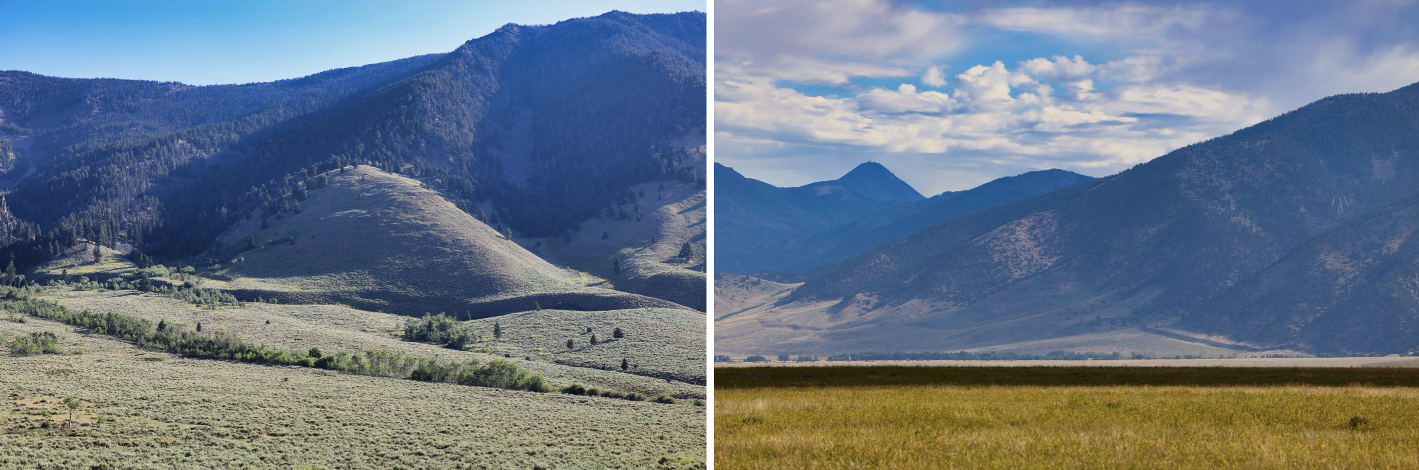
Wherever this fault plane intersects the surface of the earth, one can observe the offset along a feature called a fault scarp. The fault type is classified by the relative motion of the two sides of the fault. If the fault occurs under compressional stress, thickening the crust, it forms a reverse fault, but under extensional stress that thins the crust, it forms a normal fault. Presently our region is under extension leading to the Yellowstone, Gallatin, and Madison valleys bounded by normal faults. These valleys continue to get deeper and deeper with each earthquake—or you could also say that the mountains between them are getting taller. Just a matter of perspective.
The bottom of the Madison Valley sits 3,300 meters, or 10,000 feet, below the current valley floor. The valley is filled with sand, gravel, and boulders that have eroded off the Madison and Gravelly mountain ranges. This depth, plus the height of the mountains to the east, means that the Madison Valley normal fault, which runs about 70 kilometers from Beartrap Canyon to Reynolds Pass has had at least 4,500 meters, or 2.8 miles, of vertical movement during its history. Of course, this has occurred over millions of years, but the most recent deformation can be observed along its length.
Between Indian Creek and Papoose Creek, the fault scarp shows close to 30 meters, or 100 feet, of horizontal displacement. If this occurred during a single event, it would be close to a magnitude 8 earthquake. Yikes. Geologists estimate that these events happen about every 10,000 years on this fault—so not likely, but possible. The alluvium and colluvium that this scarp dissects indicates that this large event occurred several thousand years ago. But there are presently small and frequent tremors here, slowly relieving the stress below our feet.
A much more recent event happened in 1959 along the Hebgen and Red Canyon fault systems. It produced an earthquake of magnitude 7.5 and changed the landscape of Hebgen Reservoir and the Madison River canyon. You can visit this area and see the lasting results of a massive landslide, the resulting lake—Earthquake Lake or “Quake Lake”—and stand where the earth moved 12 to 15 feet in an instant.

It is a pleasant drive down U.S. Highway 191 to Duck Creek Y, where you will turn right onto U.S. Highway 287. Starting at 191, the Hebgen fault scarp can be seen running past the Parade Rest Guest Ranch, up into the aspens along Whits Lake Road, across the hillside paralleling the highway, disappearing at Red Canyon Creek, then reappearing at Kirkwood Creek. The Red Canyon scarp can be seen for a brief moment if you know where to look up Red Canyon Creek.

As you drive down the hill beside Hebgen Dam, the Hebgen fault scarp is seen in the forest, then can be visited at the Cabin Creek scarp site. Continue a little further and Quake Lake comes into view.
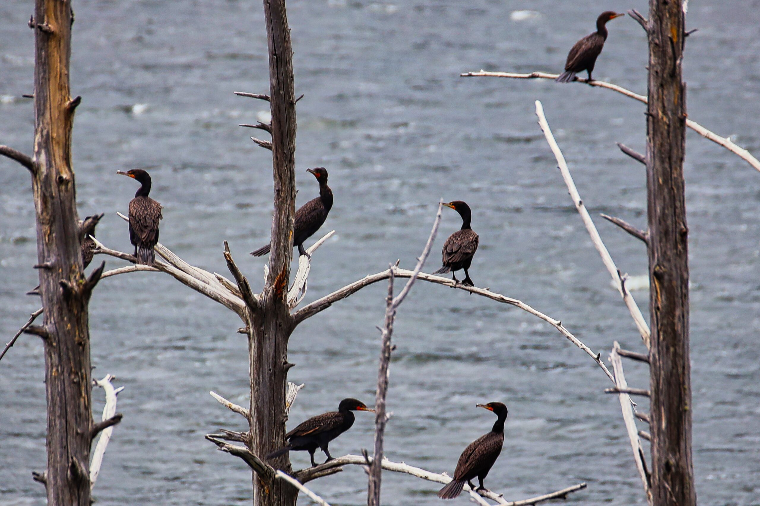
Driving along the lake is fascinating, observing nature repair itself after this catastrophic event. New trees growing along the lake as the river continues to erode through the slide, cormorants, eagles, and ospreys using the drowned trees for nesting and roosting, and mountain sheep and goats using the exposed ground for mineral licks.
So whose fault is it? All of ours. Most of these faults are on national forest land, so we can all enjoy them and learn from them.