By Paul Swenson EBS COLUMNIST

In the last column you were introduced to the sedimentary rock bookends to the drive up or down the canyon. Today I would like to introduce you to the rocks that make up 90% of the drive through the canyon.
“Well, that’s nice,” you say. To that I would say that you are correct, only your spelling is not. Yes, it is another rock pun since the rocks are actually called gneiss. Gneiss has its roots in German, Gneis, which means “spark.” When you pick up a piece it actually sparkles in the sunlight, so I guess that name aptly fits.
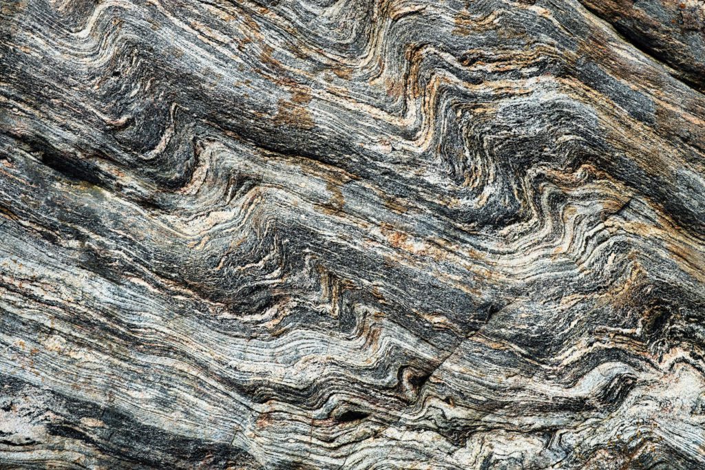
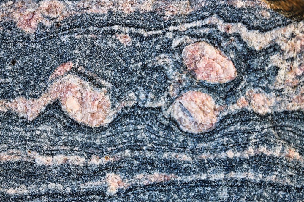
Gneiss, pronounced “nice,” is a high-grade metamorphic rock that shows a distinct banded pattern with alternating bands of light and dark minerals including; quartz (white), different types of feldspars (white and pink), micas (dark), and amphiboles (dark). There are other minor minerals that can be found associated with these types of rocks including garnets, talc, and asbestos.
The Gallatin drainage is one of the few drainages in Montana that has very limited mining history with the exception being an old asbestos mine high up the drainage behind Karst. The talc mine on the Madison River and the “rubies” of Ruby Reservoir fame—actually garnets—are associated with metamorphic rocks similar to the ones found in the Spanish Peaks.

So what does “high-grade metamorphic” mean? Let’s start with metamorphic. Metamorphism means to change composition or structure of a rock. This is accomplished by subjecting a rock to an increase in temperature or pressure or both. These increases in temperature and pressure come from forcing a rock to greater and greater depths in the Earth.
There are many types of metamorphism, but to get to “high-grade” like our rocks display in the canyon and our surrounding mountains, they had to be buried to depths of at least 20 kilometers (about 13 miles). That’s pretty deep, especially to think they are now our mountain peaks.
Now for the really cool part of the story. The rocks of the Spanish Peaks metamorphic complex are 1.5 billion years old in the southeast half of the range, and 2.2 billion years old in the northwest half of the range. Between the two distinct ages, and grades of metamorphism, lies a one-quarter mile wide “suture zone” where the rocks were joined together in a micro-continental collision about 1.5 to 1.2 billion years ago. This suture zone runs from about the Spanish Lakes to Diamond Lake then along Indian Ridge. It is difficult to know the entire extent of these micro-continents, but it’s fascinating that there’s this evidence in our backyard.

All continents began small. Then through time and the process of plate tectonics, they grow and accumulate more and more continental material. When one looks at a map of the Precambrian (older than 600 million years) basement rocks of North America, you will see it is made up from at least 10 distinct micro-continents. These were accreted together over the first three billion years of Earth’s history to make the core of our present continent.
All the other major continents also show similar structures of accretion and growth over time.
And for North America, since the start of the Paleozoic (550 million years ago), when the coast of the continent ran up the Montana-Idaho border, plate tectonics has added many small “suspect terranes” that make up California, Oregon, Washington, British Columbia, and Alaska, most of them added in the last 100 million years.
One of the largest of these terranes was interpreted to be an island arc the size of Japan that began interacting with the continent along a subduction zone around 80 million years ago. The stress associated with this collision was transferred to the east through the crust of the Earth, deforming and uplifting the Rocky Mountains over the subsequent 30-million-year time frame. This collision caused the Precambrian basement rocks, along with the overlying sedimentary rocks, to be lifted tens of thousands of feet along large fault lines that eventually gave us the Spanish Peaks, Beartooth Range, Bighorn and Wind River Range, to name a few.
So now that you know how “gneiss” it is to drive the canyon, hopefully you will be able to spot the banding in the rocks, the sparks from the reflection of sunlight off the different minerals and appreciate the fact that these rocks represent the basement of our continent.
Paul Swenson has been living in and around the Big Sky area since 1966. He is a retired science teacher, fishing guide, Yellowstone guide and naturalist. Also an artist and photographer, Swenson focuses on the intricacies found in nature.


