By Paul Swenson EBS COLUMNIST
Hello again all you EBS readers. I had a small hiatus as my wife, Lori, and I went on a fantastic camping trip with my sister and her friends. We went to an island halfway up Vancouver Island, and it was spectacular! Thanks to my sis!
As is the case with most trips, it lets one realize why we all love living here. Big Sky has certainly changed over the last several decades, but it is still a wonderful place. Before writing this column, I was staring out the window admiring the mountains, foothills, and the valley floor as they start to change into their fall attire. Yellows, golds, and hints of red and orange are all the rage this season. As the sunlight highlighted parts of the landscape, I knew I wanted to talk to you about water.
The Gallatin River seems to be getting a lot of press recently, rightly so, and I’ll leave the water quality issues to others. I would like to talk about how the river built and eroded terraces where we have developed subdivisions and gravel pits.

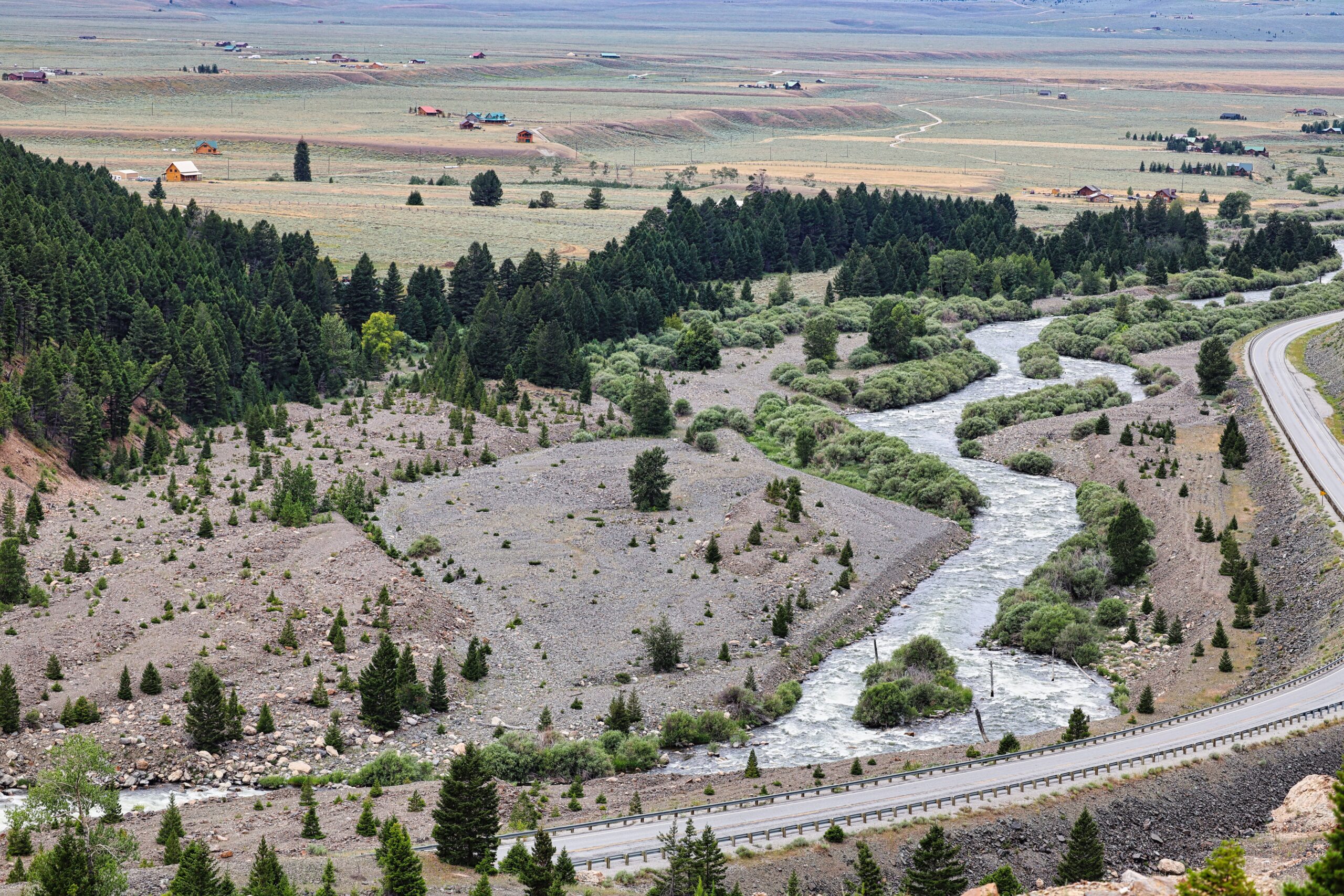
A river’s power of erosion is immense. Just look at the Gallatin Canyon. Every spring during runoff, boulders that weigh hundreds of pounds are rolled along the bottom, along with sand, gravel and cobbles. If you look closely at some of these rocks you can find chatter marks and indentations left by collisions. The collection of all these sediments is called a river’s bedload.
It is the bedload that’s interesting. It determines whether a stream or river erodes downward, or builds the riverbed upward to fill a previously eroded valley. If the stream has enough energy to transport the bedload down its course, the downward erosion will continue. But with an excess of bedload, it will be deposited at a faster rate than the river can transport it, thus causing the river valley to fill with sediment.
Here in Big Sky along the Gallatin, and along the Madison River above Ennis, there are spectacular examples of valleys being filled with bedload during the last two ice ages. These events occurred as the erosion from mountain glaciers outpaced the ability of the rivers to transport the sediment. After the glaciers melted, rivers were again able to move enough sediment downstream so that downward erosion of the valley floor occurred, leaving gravel-filled terraces along the river’s course.

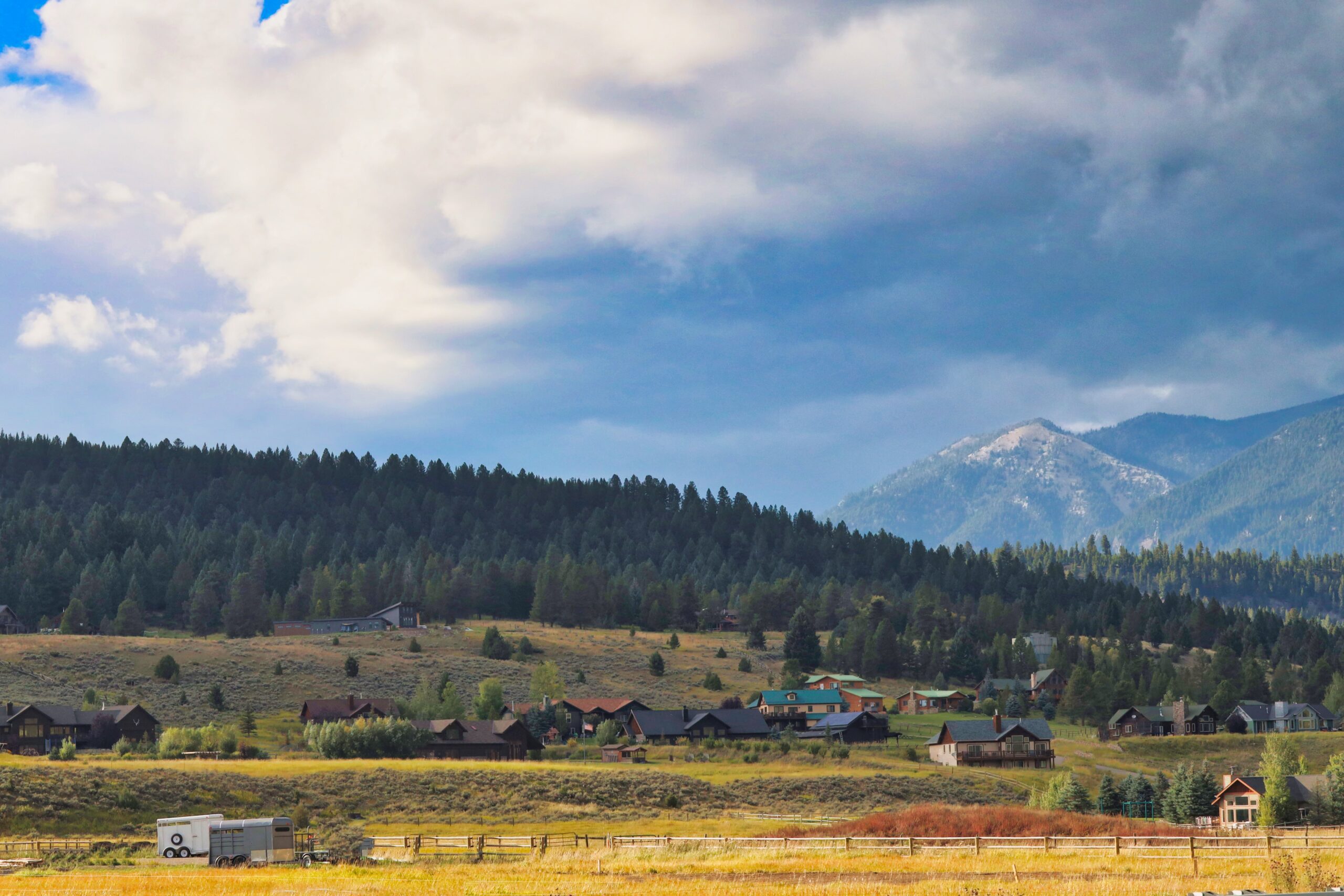
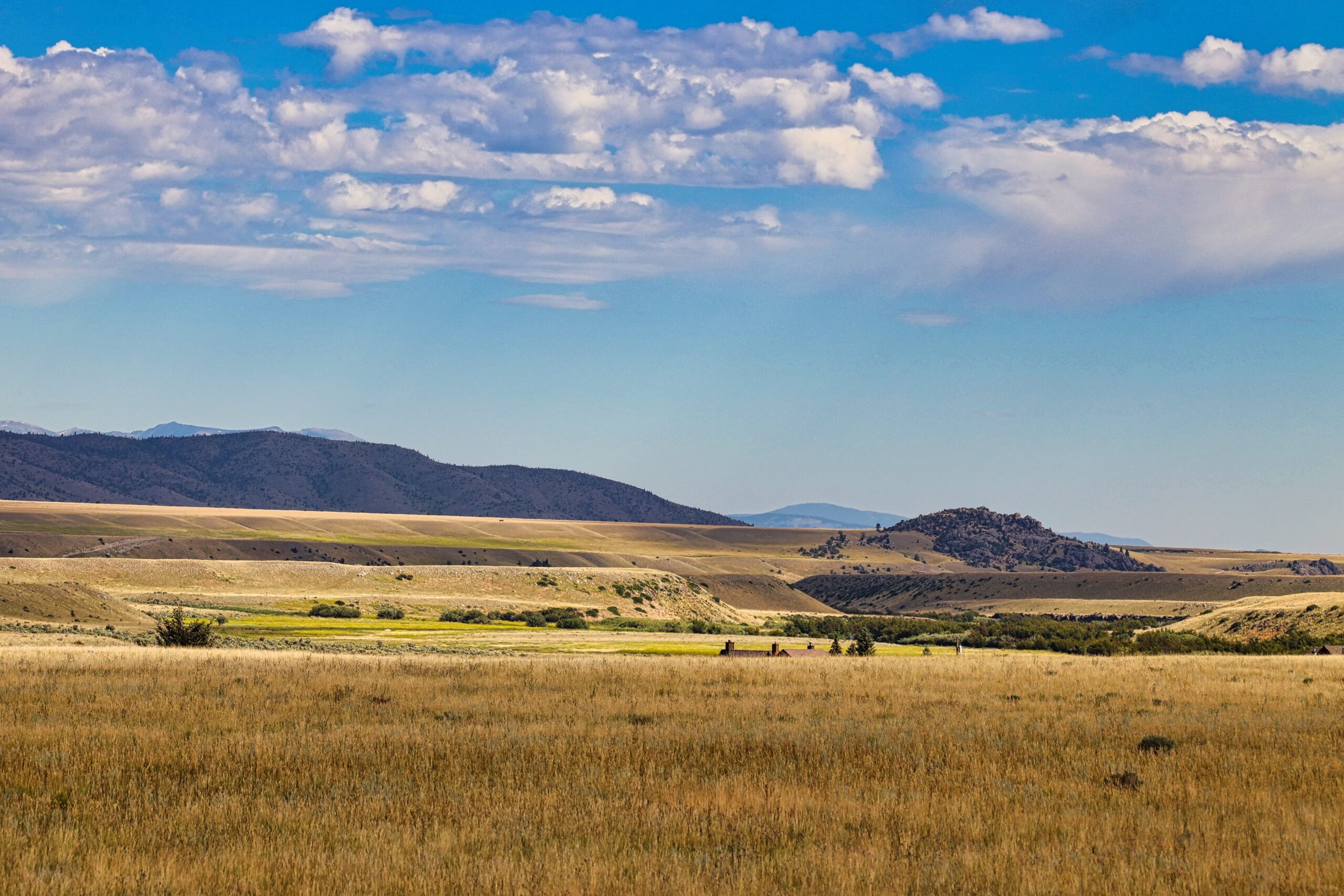
So what do these terraces look like? As you might have guessed from the photographs, sediments deposited and eroded by water usually form a relatively horizontal surface. The steep slope, or terrace face, represents where the river eroded into these gravels as the river meandered back and forth across its valley.
A recent example of this excess bedload followed by erosion happened during large outflows from Hebgen Dam back in the mid 1990s. Due to unusually large spring rains, the reservoir filled too quickly and the river had to be raised to 5,000 cubic feet per second. The Earthquake Lake slide eroded quickly in these high flows, and then built up the riverbed directly below the slide. Due to the floods and influx of sediments, the Madison changed its character from one that had many small channels, called a braided stream, into one with just a single, deep, incised channel, and created several layers of terraces that can be seen from the top of the slide.

Here in Big Sky terraces are perfect places to build houses. They are level, well drained, lower elevation and easily worked since they consist of unconsolidated sediments. So if you live in the Ramshorn or Lower Porcupine subdivisions, you are probably living on a terrace.
In addition, since they were built up from the bedload of the river, they are composed mostly of gravel and cobble, perfect for a gravel pit. It is no surprise, then, that the pit across from the Exxon station exists. There are several gravel pits in the Madison Valley, and out in the Gallatin Valley, all due to the depositional behavior of excess bedload 15,000 years ago.
So when you visit a friend in “the canyon” between the stoplight and Beaver Creek, you will be meeting them on the terrace.
Paul Swenson has been living in and around the Big Sky area since 1966. He is a retired science teacher, fishing guide, Yellowstone guide and naturalist. Also an artist and photographer, Swenson focuses on the intricacies found in nature.


