Alex Marienthal EBS COLUMNIST
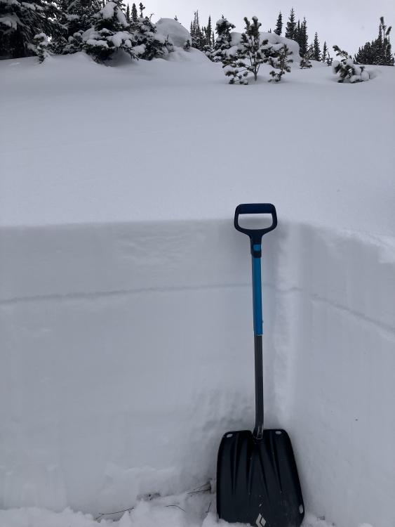
For a slab avalanche to occur, four ingredients are needed. The first (1) is a weak layer, followed by (2) a slab of snow forming on top of the weak layer on (3) a slope steep enough for the snow to slide. Then, (4) a trigger must collapse the weak layer which causes the slab to release and slide down a slope.
Triggers can be the additional weight of a human or new snow on top of the snowpack.

Slope angles steep enough for avalanches to start are anything steeper than 30 degrees. Keep in mind that lower angle terrain below a steep slope is called the “runout zone” and is exposed to avalanches from above. Under certain unstable conditions, avalanches on steep slopes can be triggered from below by people in the runout zone.
Slabs are typically from new or wind-drifted snow, and can consist of the most recently deposited snow or many layers from different storms, sitting above a weaker layer that eventually collapses under the weight of added snow or an external trigger. Most dry snow avalanches occur during or shortly after new snow fall or strong winds that transport snow into fresh drifts.
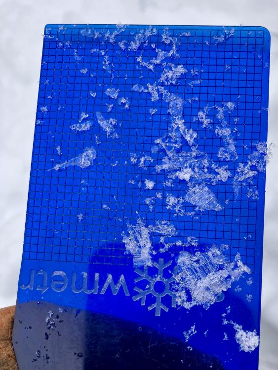
Right: Feathery surface hoar crystals that were previously buried. These ones are 8-15 mm large. PHOTOS COURTESY OF GNFAC
Common weak layers in southwest Montana are feathery crystals called surface hoar, and sugary snow called facets. These weak layers form due to a strong difference in temperature between two points in the snowpack, called a temperature gradient. When this temperature difference is large, there is a large vapor pressure difference which causes water vapor to move from higher pressure (warmer temperatures) to lower pressure (colder temperatures). This vapor pressure gradient takes water molecules from snow crystals in the warmer part of the snowpack and deposits them on snow crystals in the colder part of the snowpack, causing them to grow into crystals with sharp corners. These sharp corners prevent the snow grains from bonding to each other and form a weak layer when buried by future slabs.
The strongest temperature gradients occur at the surface of the snowpack. The snow surface temperature can change a lot over the course of a day due to air temperature and radiation loss/gain, while the temperature a few inches below the snow surface stays more consistent. Under clear skies the snow surface gets very cold compared to the snow a few inches deeper, especially at night, due to radiation loss to the atmosphere. When it is cloudy this cooling effect is inhibited. The difference in temperature between the snow surface and relatively warmer snow a few inches down causes weak, sugary facets to grow.
Surface hoar forms like dew on the grass in summer. On cold, clear nights the air is relatively warmer than the snow surface, and if there is high moisture in the air with very calm wind moisture will transport from the warmer air to the cooler snow and grow feathery surface hoar crystals.
The form and process of these weak layers is fascinating, but they become deadly when buried by a slab on a steep slope. If you recreate in the mountains in winter check your local avalanche forecast to track when these weak layers form and get buried. In southwest Montana you can get the avalanche forecast and find avalanche classes at mtavalanche.com
Alex Marienthal is an avalanche forecaster with the Gallatin National Forest Avalanche Center