By Jason Bacaj MANAGING EDITOR
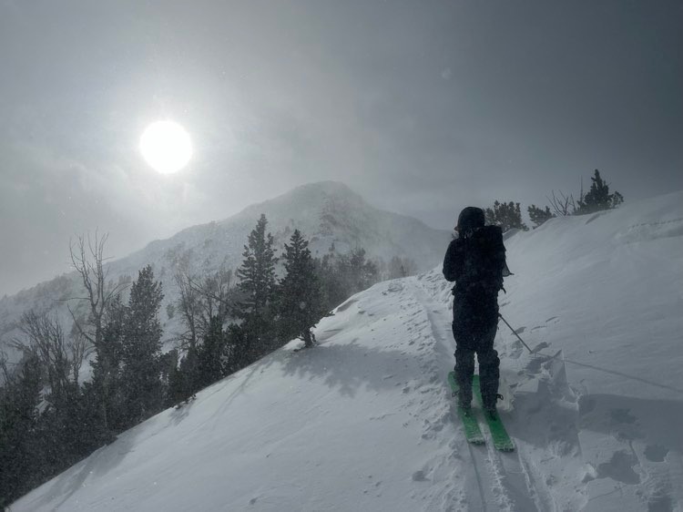
An avalanche warning was issued this morning for the Lionhead area near West Yellowstone and the Centennial Mountains around Island Park across the Idaho border.

Two feet of new snow fell amid winds as strong as 75 mph in those areas, Ian Hoyer wrote in the Dec. 2 avalanche forecast for the Gallatin National Forest Avalanche Center. The warning means that natural and human-triggered slides are likely, and that people moving in the mountains should avoid steep terrain and avalanche runout zones. The warning will expire Saturday morning.

Upwards of 10 inches fell in the southern Madison range and Cooke City, according to the forecast. Big Sky and Bozeman saw about 8 inches of snowfall in the storm. Avalanche danger in the southern Madisons and Gallatins is rated considerable.
“Snowfall stopped this morning and we just barely avoided an avalanche warning,” Hoyer said in the forecast. “Avalanche hazard is very serious today and cautious route finding is essential for safe travel.”
Avalanche danger in the Bridger mountains and the northern portion of the Madisons and Gallatins is rated moderate, with the main dangers being new snow that’s drifted into deeper cohesive slabs, the forecast stated.
GNFAC is hosting an avalanche fundamentals course in West Yellowstone on Dec. 6, from 9 a.m. until 3 p.m. Entry into the course is a $50 donation to the Friends of the Avalanche Center, and requires passing a pre-test ahead of the field session.